
Hyperspectral Assignment
In the following example we have worked with the hyperspectral imagery provided by EnMAP for testing purposes. The hyperspectral image consists of 177 spectral bands. The wavelength range of the bands starts at 0,46 μm goes up to 2,409 μm.
In the beginning were created spatial signatures of four different regions. In the figure 1, you can see the spectra (per pixel) of a vegetation, water, and two different built-up areas following similar pattern. The one with higher reflectance was probably taken from a roof top of a building, whereas the lower one is the reflectance of the asphalt on a road. The vegetation is characterized by the maximum at green visible spectrum and a rapid rise in the NIR spectrum. Having more samples of vegetated areas, the spectral intervaraiblility could be assessed. The nature of water is to absorb the electromagnetic radiation, however, in the signature we can see some changes and then predict the content of the water body.
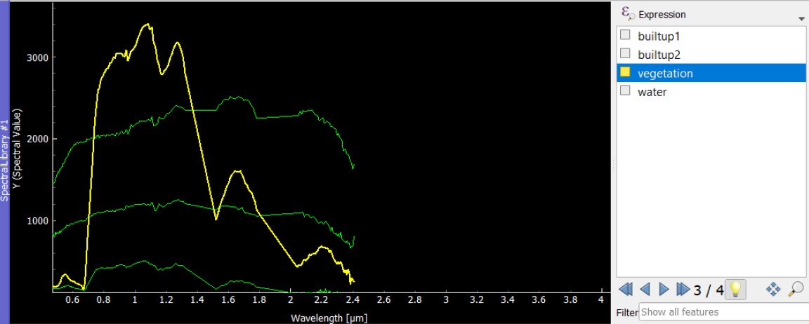 Fig. 1: Spectral signatures of two different impervious (built-up), vegetated and water areas.
 The second part of the exercise was the regression-based unmixing. The analysis makes use of synthetic mixtures from spectral libraries for regression model training. The model copes with spectral diversity, variably and mixing of the hyperspectral data. It produces land cover fraction mapping, optionally afterward a discrete classification can be calculated1.
For regression model points having a land cover class in their attribute where synthetically mixed. The model was applied to the whole image and the fraction map was created (figure 2). Based on the map the discrete classification was derived, which is not accurate obviously. There is prevalent “salt and pepper” effect across the area in case of the water class.
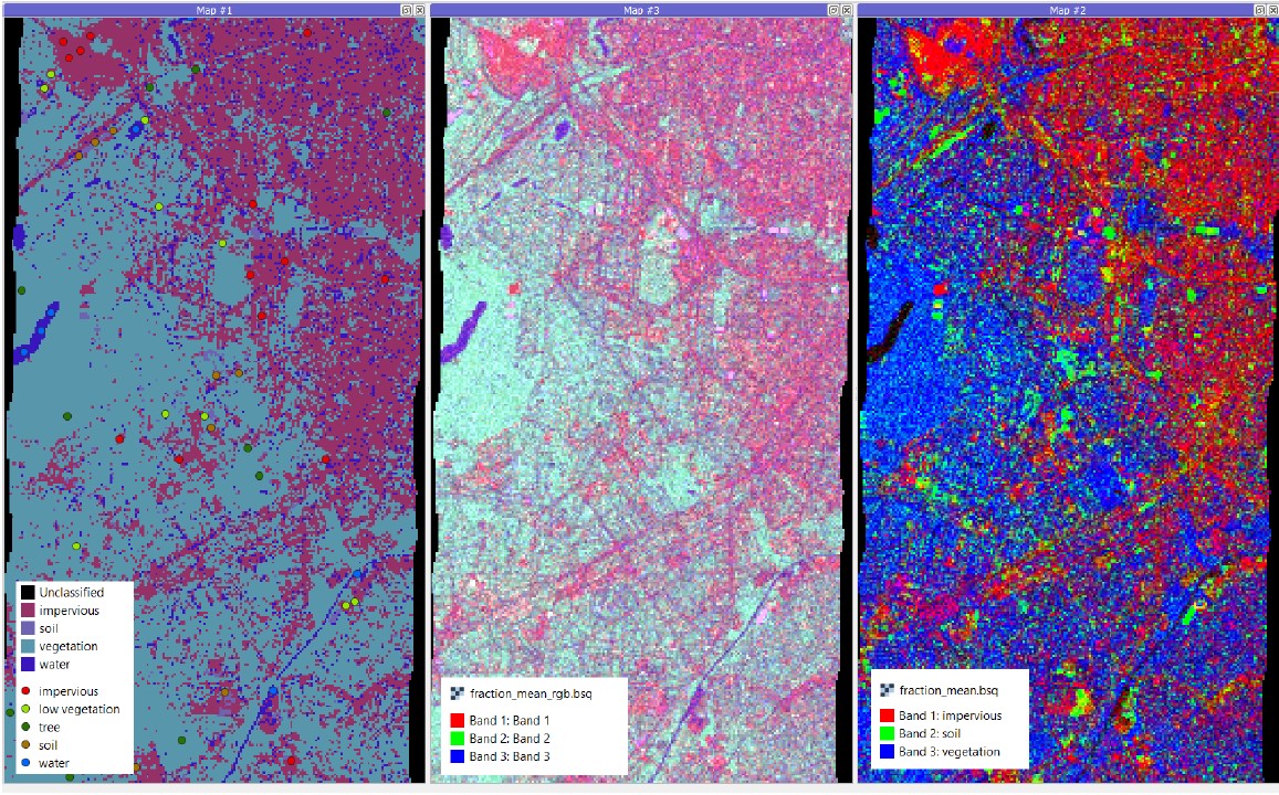 Fig. 2: Unmixing results, a discrete classification (left), RGB fraction map (middle), class fraction map (right).
 1 Okujeni, A., et al. (2019). Regression-based unmixing of urban land cover. EnMAP. Retrieved December 7, 2021, from https://enmap-box.readthedocs.io/en/latest/usr_section/application_tutorials/urban_unmixing/tutorial.html